Day 68: hard walking

Day 68
Miles: 18
Meadow with rock to Volunteer Peak

We’ve only just got back on trail when we run into two other PCT hikers taking a break. There’s a third pack next to them – “that’s our buddy’s pack,” they explain. “He forgot his wallet at camp.”
  “That’s the smallest pack I’ve ever seen!” I exclaim. “Is his food in there?”
  “Yeah, that’s everything. His base weight is six pounds.”
  “Six pounds?!”
  “Yeah. He’s hungry and cold a lot.” They pause. “He doesn’t like it when we tell people that though.”
 
J and I laugh. Having a tiny pack doesn’t get you any trail cred if you’re miserable all the time.
I have a sneaking suspicion that most super-ultra-lighters are hungry and cold a lot, but will never admit it.

The two hikers we’re talking to do not fall into that category. The dude tells us that his base weight is 33lbs – four of which come from the didgeridoo strapped to his pack. Huh. If I were to give myself a four lb musical instrument allowance, I think I’d pick something with a wider range. But, 6lbs, 33lbs, or 15lbs(my base weight), here we all are, coming up on 1000 miles.

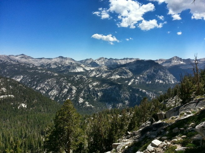
It’s more granite and forest with every mile. I feel like we’re on a slow taper out of Kings Canyon – still beautiful, but easing up on the overwhelming spectacular. The huge ups and downs have turned into small ups and downs, the sheer cliffs only a rocky giant’s playground. Hard walking.

A small lake – Miller’s lake – calls our name. Blue, almost warm, thronged with bright blue damselflies. For once, for a minute, the mosquitoes let us be.

By afternoon, it’s the same ol’, same ol’ behind on miles, hard walking. I can feel myself being increasingly neurotic about miles, and I hustle J all day, hustle myself, walk faster, walk faster, walk faster, walk faster! I can’t walk any faster! I’m exhausted. This section of trail is brutal.

“Why is this section so hard?” I bemoan to J.
  “Don’t you remember the Davids telling us that this is probably the hardest section of the entire trail?”
  “I think I missed that memo.”

I’ve gotten it now though. Holy smokes.

At three in the afternoon we come out on the ridge over Matterhorn valley. I’ve seen this valley before, I’m sure of it – perhaps in the book of fairytales I read as a child. This is where the Enchanted Kingdom lies… too bad that’s not where we’re going. No time to waste, we should be walking faster.

We pass Smedburg lake in the late afternoon. Lots of hikers setting up camp. “There’s room over here,” calls out a fellow hiker.
  “We’re going to do two more miles,” we reply. Two of the worst, hardest, rockiest, steepest miles yet. Why do I always need to do two more miles?

The setting sun shines off the glacier polish, lights up Volunteer Peak, which is behind us now. Only 18 miles today. We’re going to run out of food if we don’t start hiking faster. Maybe tomorrow.

image

image

image

image

Glacier polished porphyritic granite

image

Volunteer Peak

Share

Day 67: someplace old/ someplace new

Day 67
Miles 10
From Tuolomne Meadows to meadow with rock

  “Wow, that’s quite a total!” Exclaims the man behind the cash register. J and I have opted to resupply at the Tuolomne Meadows store instead of mailing ourselves a box. It ain’t Wal-Mart prices, but it’s ok. We’re buying 150 miles of food – seven days if  we’re fast, eight days more realistically. Estimating a dollar a mile works pretty well to keep our bellies full, but we’ve only rung up $250 of groceries at the little store. The cashier might be impressed, but that leaves us fifty bucks short… We look at each other.
  “It’s a lot, but I don’t know if it’s enough,”  J replies.
  “Let’s just go repack it and see how it looks,” I tell him.

Overwhelmed by the piles of food that we divvy up, we do not buy any more food. We have to carry this mountain of pop tarts, mac n’cheese, crackers, candy bars. Surely it’s enough?

It’s a gray, drizzly day. Matches my attitude. We sit at a picnic table with some other PCT hikers, not hiking.

We’re approached by a man in a sweater, with a beautiful handlebar mustache. He’s an artist, taking portraits of people of Yosemite. Today, that’s us. He lets us pose however we want, and I lean on my trekking poles, look straight at the photographer as he ducks under his little black curtain to click the shutter on his old fashioned 4×5. Every cell in my body feels self aware and tingly with the force of the full attention of another human being. When was the last time I was looked at so completely? To be seen as I am, or as I wish I would be?

Since we’re already holding our trekking poles, packs on, shoes tied, standing on the trail even, it must be time to go. Is thru-hiking turning into a chore? An exercise in self punishment?

We walk through the gray day into the meadow, smooth gray domes populating the horizon, smooth, gray water running through the field. We come to the waterfalls before Glen Aulin, think of the Davids. J falls asleep on a rock, I lean on my pack.

The Grand Canyon of Yosemite is opening before us but we take a hard right turn to the north. “I hiked here with my dad once,” J mentions. “We camped at a meadow with this incredible giant rock. We sat up there on it, watched a big, beautiful owl fly below us.” The giant rock appears before us, size of a house. It’s drizzling again. We planned on going another five miles, but we set up the tarp behind the house-boulder. Home again.

image

image

image

image

image

Share

Day 66: rainy day

Day 66
Miles: zero
Tuolumne Meadows

We posted a note for Bluesman on the Tuolumne Meadows campground message board, but no sign of him yet. We’re not entirely sure if he’s ahead of us or behind – we think he got caught up in Mammoth. It would be great to see him again before he gets off trail for ten days. Who knows if we will ever meet up?

At the campground, the groomed, lovely, and stylish climbers pack up and head back to Berkeley. Dan and Christina hang out a little longer. We had discussed going climbing, but we’re exhausted and Christina is ill. And it’s raining. It’s nice to have a day that’s not all business, that’s slow, that’s unrushed. We meant to take care of all sorts of business today, but a recent rockslide took out the cell towers and landlines so we’re off the hook. I buy a postcard for my mother at Tuolumne Meadows store and get in line for the Post Office, where a queue of dirty hikers are holding their postcards for their mothers. Don’t want to have Search and Rescue chasing you.

Dan and Christina don’t get to stay for the entire day, which is a disappointment. It’s so nice to see old friends.

I first met Dan and Christina a couple years ago, on a climbing trip to Joshua Tree. Dan was getting ready to launch a kickstarter campaign to produce a rechargeable headlamp (at the time, there weren’t really any on the market from the big name brands). He was able to get fully funded, get his headlamp produced, and launch his company, . J and I are using Bosavi headlamps for our thru-hike. Super lightweight, super bright, and no AA batteries for the trash.

Despite being a beautiful product, without a big name behind him, Dan has not been able to get his headlamps stocked at any of the big outdoor gear stores (REI, I’m looking at you). The company was doing ok, and then everything went up in flames.

Big, redwood timber, tarpitch roof flames. The warehouse with all the production equipment, designs, tools, and extra stock was burnt to the ground when one of the other tenants left a pile of oily rags sitting in a corner. One little spontaneous combustion, next thing you know, all your hard work is little lumps of char. The metal tools melted to the floor.

The bad news is that Bosavi will never produce another headlamp. The good news is that part of the inventory was stored off-site, and there are 400 of rev 2.0 Bosavi . I think they’re a great product – can’t think of a better endorsement than taking it on a thru-hike – so if you need a headlamp, check it out.

Once Dan and Christina take off, I take the book that we acquired yesterday, sit down at the picnic table, and don’t move for the rest of the day. It feels like the lap of luxury.

It’s almost dark when we hear someone walk up to the campsite and call our names. It’s Lapis! We’ve been crossing paths since Big Bear. She saw our note for Bluesman on the message board and came to find us. She joins us at the site for the night. I suppose tomorow we will have to finally do our resupply chores and walk out of here, but I’ve got one more night to rest.

Share

Day 65: the stone staircase

Day 65
Miles: 22
From Ansel Adams wilderness to Tuolomne Meadows

Fell asleep hard last night, but I’m still tired. I’m tired all the time now. I sort of thought I’d be used to this? That my body would catch up? Instead, it seems like every time I get a little stronger that the trail gets a little harder. I hoped my new shoes would help, but after a one-day reprieve it was straight back to foot pain. Blast.

Our morning takes us up and past Thousand Island Lake. It’s beautiful, in classic High Sierra fashion: white mountains, pink flowers, green trees, blue lake. We crossed into the Ansel Adams wilderness area yesterday, and I’ve been thinking about his photos, and how he could hold the soul of this place on a black and white print, this place of blue green white.

We’ve got our last pass of note coming up, Donahue Pass, then onto Tuolomne Meadows. Onto a real day off! Maybe with just a real day off I won’t be so tired anymore. Maybe I won’t feel so thin.

Up and over Island Pass, which I didn’t realize was a pass, or that I was crossing it, until just now, where the sign marks it. I keep thinking we’re going to be out of the high country for good, but the smooth, glacier-polished land of marmots and green grass and knife-edged peaks reappears. The pass is a wild tumble of boulders and stone, with a trail blasted and built into an infernal stone staircase, with every step either too high or too short or too long or too shallow. “Right or left?” I ask J, pointing at the ridgeline. “Which I’ve do you think is the pass?”
  “Right.”
  “Really? I thought left.”

It is left. For someone used to looking at rocks, J has maintained an astonishing record of zero correct guesses on the passes.

Up at the top another hiker hails us: “Welcome to Yosemite!” We’ve made it to the park. J and I sit down next to a teeny melt lake for lunch.  There are two guys, David and David, eating there as well, and next thing you know we’re chatting about gear. I love talking gear. It drives J crazy. I can’t help it. If he’d ever been to a reunion with my dad’s family he’d know why. Talking gear is what I was born to do… Even if the gear in question is poop trowels and butt wipes. (Of course I carry butt wipes! A little heavier, sure, but you don’t need ’em until you do!)

A David pawns off his book on J. He wanted a new book, but maybe not a hardback. As we leave the same David tells us – “when you get to the waterfalls beyond Tuolomne, tell it hello for me. It’s where I was baptized by the universe!”

Down Donahue Pass turns out to be a different endeavor from up. Much longer, for one thing. Endless, to be more exact. Unending. Brutal. They must have built this trail in the thirties, because there surely has been no other time since when backbreaking physical labor has come so cheap, so abundant, as to even imagine what they have done here. Miles and miles of carefully built stone stairs, hand cut, hand blasted, hand laid. I don’t even appreciate it, this rocky stumbling ground of stairs that are, every one, the wrong size.

The downhill is endless, but somehow passes. It always does. We begin the second infinite section of the day, the flat, easy walk along the Lyell River to Tuolomne Meadows and friends and rest. It’s a storybook meadow, a green corridor between forested mountains, a wide, blue meander winding through. For nine miles. Easy, if the entire High Sierra hadn’t come first.

Tuolomne Meadows is a teeming tent city. Fourth of July weekend. I thought the JMT section of the trail felt crowded, this is a metropolis! We make our way, limping, the message board. J’s long-time friends Dan and Christina should be here to meet us, and hopefully they left a note.

“Hey!” Hollers a car behind us.
  “Dan!” J hollers back. We found them!

Dan and Christina live in Berkeley, and they’re here camping with a big crew of climbing friends. Everyone is fit, strong, stylish, clean. I feel like a schlub, a dirty, tired one. They welcome us and feed us all the same. I’m so glad I don’t have to walk anywhere tomorrow.

image

Thousands Island Lake

image

Coming down Donahue Pass

image

Whose idea was this??

image

The Lyell River

Share

Day 63: afternoon push

Day 63
Miles: 26
To Red’s Meadow
Over silver pass

The big passes, as I like to think of them, are all over, but the little ones remain. (Only 10,000 feet? Not impressed.) So up and over Silver pass. It may not be a big pass, but I’m feeling tired nonetheless. Always tired.

Silver Lake, Lake Virginia, Purple Lake – all are a brilliant blue. Now we’re leaving the land of the lakes, into the trees, a quiet, dry forest walk.

If we do 26 miles tonight, we’ll make it to Red’s Meadow. Our maps say: free hot springs showers. I hike faster and think: free hot springs showers. Ice cream. A burger. Hike faster. The day is a blur of trees and hiking faster.

The landmarks on our map begin to have very volcanic sounding names: crater creek, red mountain. It all becomes clear when a giant cinder cone appears in view. It’s shocking to see rock that isn’t granite, isn’t white. Do rocks come in other colors?? I wonder what burblings of magma, what gyrations of stone, conspired to conjure up this black cone.

Coming down off a huge ridge, we look across a valley and see miles of downed trees. “Do these trees all look like they were blown over to you?” I ask J.
  “Blown over? They look like they were ripped straight out of the ground!”

Giant trees, roots ripped straight out. All the trees have fallen in the same direction. Are there tornadoes here?
A day of natural mysteries. I don’t care. I just want a shower. J and I stumble into Red’s Meadow dirty and exhausted.

The cafe is closed. The showers are not free, and they are closed. The store’s sign says it is closed too, but the proprietor is still there, and he sells us canned soup, ice cream bars, and soda. So there’s that.

The campground is another half-mile, so we limp to it. We had heard there was free camping, but we can’t find it, only pay sites. Another hiker finds us standing there, sad and confused, and takes us back to his site. It’s a group of JMT hikers. They’re only supposed to have six people per site, and we make it seven. “You guys are pretty unified, right?”
  “Totally unified.”

They are unpacking their food drops, and we inherit larabars and drink mix and snacks.

We were planning on going into Mammoth to resupply, but we packed too much food out of Bishop. Between what we still have, what we’ve just inherited, and what we can buy at the store, we’ll easily make it to Tuolomne Meadows. It would be fun to celebrate the Fourth of July in town, but we’re trying to meet J’s friends who will be in tuolomne for the weekend. So we’ll hike instead.

I sure wish I’d gotten to take a shower today…

image

Silver Lake

image

image

image

image

Lake Virginia

image

Purple Lake

image

(Phone is out of battery 🙁   )

Share

Day 58: a long uphill

Day 58
Miles: 15
From Rae Lakes to Lake Marjorie
Pinchot Pass

It’s raining on J. Cold, wet drips, as the frozen condensation inside our tarp melts, splash on his face. None of them hit me – I’m happy to stay in bed – but J feels otherwise. We can hear Teal hacking even though we can’t see him. He succumbed to temptation and smoked during his time in town, and he sounds like the Marlboro man, 30 years after the commercials. Guess it’s time to get up.

Bluesman takes off ahead, then Teal, with me and J bringing up the rear. We hike downhill a long ways, then turn into another valley and begin the long uphill to Pinchot Pass. Teal is under a tree, eating skittles. We throw down our packs and join him, and I put on my windshirt despite the warm sun. “I thought this was a windshirt,” I explain, “but it turns out it’s actually mosquito armor.”
“The mosquitoes can still bite you through that,” J chimes in.
“No they can’t.”
“Yes they can.”
“Well, they choose to never do so then.”
“That’s considerate of them,” J replies, irritatingly.

The mosquitoes have been sneaking up on us, absent sometimes, swarming others. It figures that someplace this amazing would have something wrong with it… a high-pitched whine in your ear and an itch you can’t scratch. I switched to wearing pants for the sun exposure, but now I’m doubly glad for the protection.

Starting up the uphill, I charge it. We run into our buddy Crush, getting water at a stream with two other ladies I don’t know. I had thought Crush was way ahead of us – he’s got legs like a seven-foot tall gazelle – but I think he gets hung up chatting with people. He’s always saying ridiculous things, preceded by the phrase, “as they say in Texas…”. His rationale for this is that there are enough people in Texas that no matter what he says, someone else there has probably said it at least once. The two ladies introduce themselves as “the girls.” They’ve just jumped on the trail a few days ago.
“Well, if you’re the girls, then one of you is left and one of you is right, right?” I ask them.
“I thought the same thing, but figured I didn’t know them well enough to say that,” Crush laughs. We pass on by and keep charging up the hill.

I’m exhausted. Why am I charging uphill? Why is this hill so big? “How far are we?” I ask J.
“Looks like about 4 miles to the pass still.”
“4 miles??” I throw my pack down and nearly have a meltdown, but I need to make a trip to the bushes more than I need to throw a tantrum. I’m sitting there with my pants around my ankles when I spot a lean, dun shape moving through the bushes nearby. “Mountain lion!” I think. “I’m going to get eaten with my pants down!” I hold perfectly still and watch, and the shape emerges again – with a sharp nose and bushy tail. Coyote. It’s a beauitful specimen, a bit thicker than the scrawny desert dogs I’m used to.

Four miles is long ways, but we walk it. We’re coming up on the pass – a long mountain ridge closing off the bowl we’re walking in. “Which spot do you think is the actual pass?” asks J.
“Mmm, I think it’s that low spot over there,” I reply, pointing to a dip in the ridge.
“I think it’s that one,” J says back, pointing to a different one. But I won the flip of the coin and we head to the right.

My favorite part of going over a pass is the moment just before you crest, when all you can see of the other side is bright blue sky, and there might be anything over there – lakes, castles, the waterfall over the edge of the world maybe. Then you crest, and it’s sharp ridges and mountain waters and Bluesman, waiting for us to share the view. We sit on top of everything and eat snacks.

Crush and the Girls are not far behind, and they stop for snacktime too. Another hiker, (who, inexplicably, has packed his pack so that his bear can dangles and smacks him in the butt every step he takes) makes the top as well. The Girls had assumed that their hiking partner was right behind them (he also, inexplicably, packs his bear can so it hits him in the butt) but it turns out that we’d all been mixing the two guys with giant packs up, and the dude hiking with the Girls is actually several miles behind, with altitude sickness. “Did you guys ever discuss what you would do if you got separated?” I ask them.
“Uh, no.” Soon, the conversation is all about plans of action, whether to go back, or leave a note, or ditch him because they don’t like him. I’m all involved until it suddenly dawns on me that this conversation is about attention, not solving the problem of a greenhorn hiker with too big of a pack and altitude sickness, and alone. I leave.

I left the conversation, but it keeps bothering me that there seemed to be no plan to go back and make sure this dude was ok. I don’t care how big of a prick someone is, it’s bad form to ditch them without even telling them about it.

We get to Lake Marjorie in the evening, just as the mosquitoes come out to swarm and the fish are out to bite. J takes his rod and catches us a whole mess of little brook trout that we steam with wild onions we’d found earlier in the day. After pasta sides and crackers and stale cookies and ramen, fresh trout tastes so real. The Girls show up, sans hiking partner. We go to bed late enough that we’ve outlasted the mosquitoes, and don’t set up the net-tent. Mather Pass tomorrow.

Share

Day 57: Double Duty

Day 57
Miles: 13
From Bishop (via Onion Valley Trailhead) to Rae Lakes
Kearsarge Pass and Glen Pass

An entire extra day of prep should have had us on the move with rocket boosters this morning… alas, procrastination begets more procrastination. Post office, packing, diner breakfasts, re-packing…I’m not sure we’ll ever get out of here.

At the post office, there’s a beautiful old GMC High Sierra. “High Sierra!” says J. “Cool logo,” he adds, and snaps a photo before he goes in. Tess and I are waiting out front when an older gentleman comes up to us, gets in my face, and accusatorily says, “What were you doing taking a photo of my truck!”
“uh, just the logo sir! We’re hiking the High Sierras, and you’re driving a High Sierra! Cool, right? ha ha?” The old man is not placated, but leaves us alone. I didn’t know I was so suspicious. Sheesh.

Packed to the gills with bacon and pancakes, no more chores left to delay us, Tess drives me, J, Bluesman, and Teal up to the trailhead to depart. It’s 1:30pm and we have two passes ahead of us. Our packs sink low on our hips with 8 days of food – the most we’ve ever carried – and we start up the thousands of feet of elevation leading up to Kearsarge Pass. I’m starting off right, with a trip and a stumble and flat on my face. “oof,” I mutter, from underneath my pack.

I bought new shoes in Bishop, and if this is any indication of how they’re going to treat me, things are not looking good. The gear store didn’t have the model of Salomons that I’d been wearing (the XR Mission), so I swapped in the XR Crossmax – it’s similar, but with a thicker foam sole, which seemed like a good idea yesterday. Problem is, the sole is also narrower, and I feel like I’m trying to hike in platforms. The shiny, pink kind. I roll my ankle again and again, cursing more every time.

Despite all that, it feels so good to be back on the trail. I’m starting to feel lost in the trail towns, like a fish in a suit. It’s not my place, and I’m overwhelmed by the stripmalls and food and people and internet. Walking is easy. One step one step one step. We charge up Kearsarge pass, finish the seven miles from the Onion Valley Trailhead, and finally re-join the PCT, leaving the desert and towns safely behind the mountains. I don’t want to see them, I just want the mountains, and the lakes, and the snowpack, and the wild. Forever.

Kearsarge Pass was a bit of a haul. Too bad it’s not our only pass of the day – Glen Pass awaits. My back-on-trail optimism takes a bit of a beating on the switchbacks, but I huff and puff to the top, where I find Bluesmand, surrounded by JMT hikers, where he regales them with PCT battle stories. Teal comes up right after J, and in the late afternoon we descend towards Rae Lakes in the Golden Hour. Bluesman drags us a few more miles and then we set up camp. Taking off my pack feels like getting out of prison, and we set up our tarp facing the Painted Lady Peak, it’s top still lit up like a Christmas Star for one more minute. The lakes are beaten silver, the trees black against darkening peaks, and words cannot do justice to this place. I’m exhausted. Pinchot Pass tomorrow.

20140627_164137_1[1]
Over Kearsarge pass, back in the promised land.

20140627_165215_1[1]
Bullfrog Lake

20140627_184738_1[1]
Coming up Glen Pass

20140627_191728_1[1]
Bluesman and Teal, heading down Glen Pass

20140627_192315_1[1]
Over Glen Pass

20140627_192730_1[1]
The golden hour…

20140627_194949_HDR_1[1]
J (aka Dirtnap) heading downhill

20140627_201011_1[1]
Last light on the Painted Lady

20140627_203239_1[1]
Twilight over Rae Lakes

Share

Day 54: Over and Out

The sun rises right into my tarp – I squint an eye open at the fabulous dawn, then settle back into a content morning snooze. It’s going to be a town day anyhow.

We finally all get up and start the stiff hike up Kearsarge Pass. For some reason, I failed to connect the word ‘pass’ with ‘really steep climb up a mountain’. The trail is catching me up to speed on my vocabulary though – I’m huffing and puffing and about to bonk. J feeds me some snacks and we keep going. The grade on this section is ridiculous. The traffic on the trail is also something new too. Mt Whitney marked the start of the Pacific Crest Trail’s intersection with the John Muir Trail, and we pass dozens of JMT hikers, day hikers, section hikers, and weekend backpackers in a day. After having a trail all to ourselves for weeks now, it’s a bit of a shock. Especially since they are all going the other direction. 800 miles of looking at north pointing footprints, and suddenly they are all the wrong way. I feel like a lost salmon.

Up and over the pass, next to the incredible Kearsarge Lakes. The trail down to Onion Valley faces east to Owens Valley and the White mountains, down to dry country. It looks hot down there.

Motivated by visions of milkshakes and burgers, we burn the downhill miles. My hipbones are feeling especially abused these days, so I unbuckle my hipbelt and let my pack hang on my shoulders, where it feels about ten times heavier. For the first three days with my bear canister, I was packing it at the bottom of my pack. At the end of the third day, I only had to look at my pack to feel the implacable round case in the small of back, and putting on my pack had developed into a long, complicated process of layering extra clothes and dirty socks around my waist for some extra padding. It finally occurred to me to change how I was packing my pack, and my life instantly improved. I’m using the ULA Ohm 2.0, and it’s a tall, narrow pack, lightweight pack. It works great if you pack it right… For now, I pack my sleeping bag, sleeping pad, and net-tent in the bottom, using socks and gloves to fill in the gaps. The bear can slides in (upright) on top. Rainpants go between the can and my back, long johns fill in the sides, extraneous clothes squeeze in the cracks. So far, so good. It doesn’t collapse around the middle anymore; I no longer hate my life; I can get into my food without unpacking everything; it carries like a dream again. However, my hipbones are raw and deep purple from the first couple days, and they don’t seem to be recovering while I carry a pack on them for 10+ hours a day. Maybe a rest day will do the trick.

There are trail angels waiting with food at the Onion Valley trailhead – Uber-bitch and Bristlecone – far lovelier people than their names suggest. They feed us tortilla soup and grilled cheese sandwiches and give us a ride down to Independence. We emerge into a hot, dusty town – we’re an entire mile lower than we were this morning. Teal and Tess pull up to the Chevron and pick up Bluesman, Dirtnap, and me – trail friends, reunited again.

Share
post

Day 33: back on the trail again

Day 33
Miles: 18
From hiker heaven to the Oasis water cache

After wrapping up some loose odds and ends, I’m finally ready to leave hiker heaven. “Do you have a donation box?” I ask Donna.
  “Over there,” she points to an ugly vase back in the corner of the garage. The Saufleys can’t possibly be covering their costs. I wonder if it is the transformation they appreciate – watching tired, filthy hikers coming to their respite, only to leave refreshed, clean(ish), and in good spirits. I feel like I might be ready to go on. We get a hug and our picture taken, then it’s time to go. Dimples and Snake Eyes start off with us today – can’t go wrong with some good company.

Based on the reports and hearsay from other hikers about the horrible, dry desert coming up, I keep expecting to be walking through blazing hot, rocky wastes. This hasn’t happened yet. Today we take off into hills that are golden and green. The land here looks rumpled, like an old quilt, patchworked in greens and yellows here, blues tans and greys out in the distance.
Read More

Share